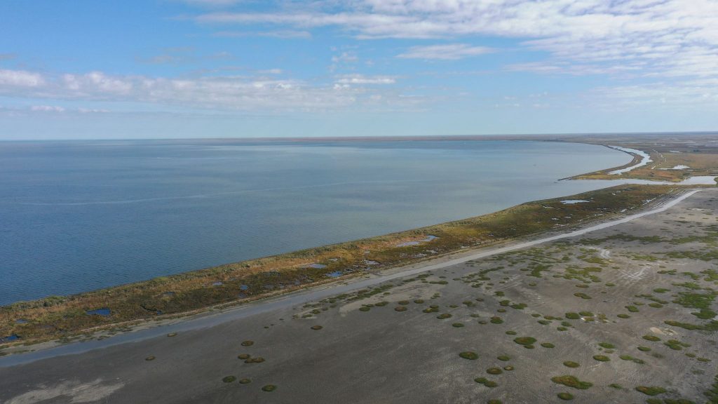
Turning open water into land isn’t magic—it’s engineering. Along the south shore of Lake Borgne, one of Louisiana’s most significant marsh restoration projects is demonstrating how science, sediment, and long-term planning can help reclaim land lost to decades of erosion and storms.
The completion of the Lake Borgne Marsh Creation Project marks a major milestone for St. Bernard Parish, where land loss from saltwater intrusion, subsidence, hurricanes, and impacts from oil spills transformed once-thriving marshland into open water. That loss left nearby communities increasingly vulnerable to storm surge and flooding.
GeoEngineers played a key role in this landmark restoration effort, which became Louisiana’s largest marsh creation project by acreage. The project restored approximately 3,180 acres of marsh using more than 15 million cubic yards of dredged sediment—enough material to fill the New Orleans Superdome nearly three times.
Protecting Communities Through Coastal Restoration
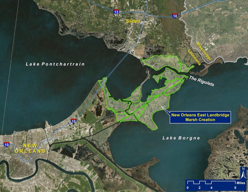
Lake Borgne is a critical natural buffer against hurricanes and severe Gulf storms. Located southeast of Lake Pontchartrain, the area plays an essential role in protecting the Greater New Orleans region. The project was led by the Louisiana Coastal Protection and Restoration Authority (CPRA), a longtime GeoEngineers client, as part of the state’s broader Hurricane and Storm Damage Risk Reduction System.
Engineering a New Marsh
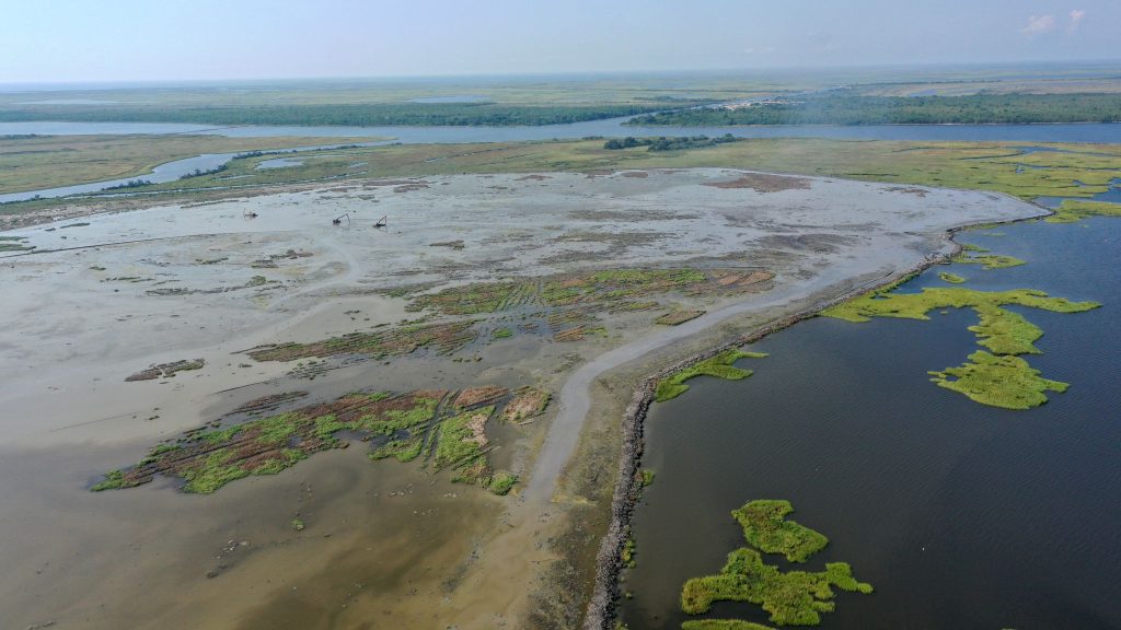
To restore the marsh, sediment was excavated from the bottom of Lake Borgne and hydraulically dredged into contained marsh creation areas formed by earthen dikes. GeoEngineers conducted subsurface investigations, laboratory testing, and engineering analyses to help determine how much fill was required and how much marsh could be sustainably created.
The team provided design recommendations for the containment dikes, including evaluations of settlement, bearing capacity, and slope stability. GeoEngineers also assessed how the sediment-water slurry would settle over time to ensure the restored marsh would reach its long-term target elevation and support healthy vegetation.
During construction, GeoEngineers supported the project team by implementing and monitoring instrumented settlement plates (ISPs), which helped determine when sufficient sediment had been placed and when material had properly consolidated. ISP data, combined with sediment testing, allowed the team to track construction progress and confirm performance through project completion.
Building Resilience for the Future
Marsh fill placement was completed in 2025, and the restored landscape is already enhancing the region’s resilience to storms. While newly created marsh may initially appear waterlogged, the dredged material is designed to dry and consolidate over time, forming stable soils capable of supporting robust, vegetated marshland—far more resilient to storm surge than fragmented or degraded marsh systems.
The project also incorporated elements from nearby restoration efforts, improving efficiency while helping restore additional marsh areas and natural ridges that support local wildlife and maritime forest habitat.
A Lasting Impact on Louisiana’s Coast
GeoEngineers’ long-standing partnership with CPRA reflects a shared commitment to protecting Louisiana’s coastline and the communities, ecosystems, and industries that depend on it. The successful completion of the Lake Borgne Marsh Creation Project is another step forward in strengthening coastal defenses and restoring land where it is needed most.